Levee Inspections
To attempt to take up the mantle from Howard of saving Pennsylvania from catastrophic flooding this week I have been out conducting inspections of elements of the levee network. Every year Baltimore District inspect half of the levees in their AO, which broadly covers Pennsylvania and a section of upstate New York and control flow into the precious Chesapeake.
Sadly my image of Hollywood style concrete channels where we could put the hire car to the test were dashed and replaced by oversized earth berms. I imagine this is the slow time equivalent version of the inspections carried out in six weeks by RE JNCOs in the UK last spring, except completed by two qualified Professional Civil engineers and a couple of hangers on like me.
Below shows a typical levee and our main tasks were to look out for ‘critter’ holes and the wrong type of vegetation. A common occurrence is for groundhogs to burrow completely through the levee, both allowing flow but also destabilising the remainder of the levee. Vegetation is important to promote soil stability but has to be able to bend to the flow to avoid creating an obstruction, or a place for obstructions to settle. Within the main straight channel to the bridge in the distance a meandering path has been engineered for the normal flow condition slowing the flow down, whilst allowing it to drain quickly in a flood condition.
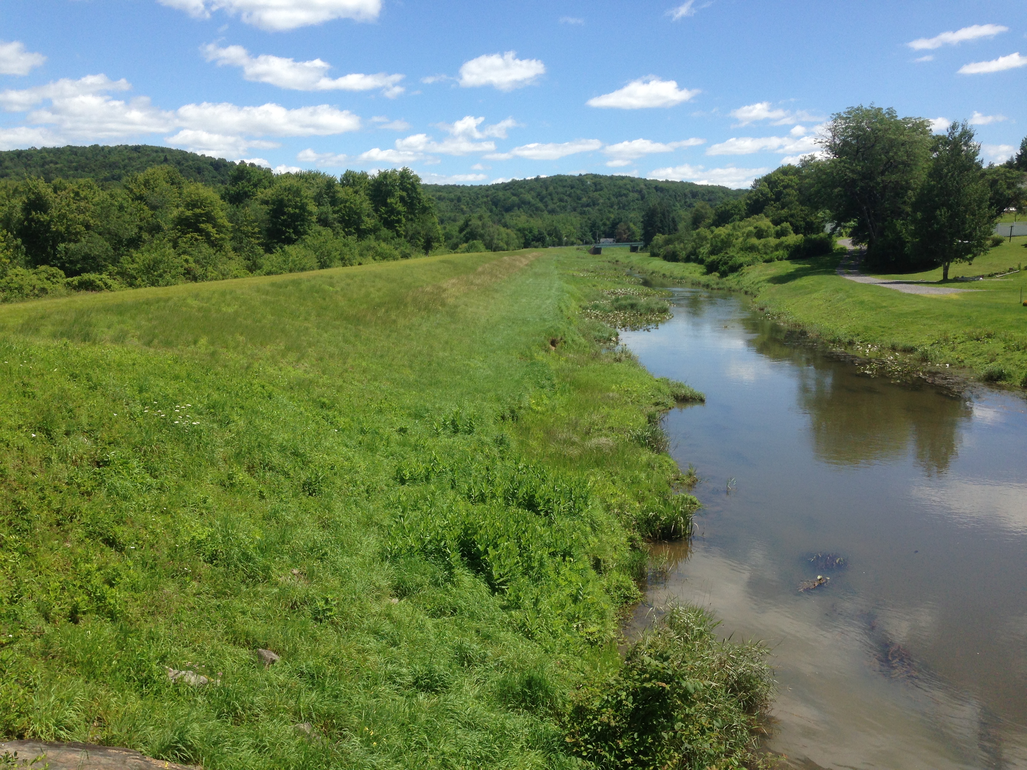
Typical levee and channel
To control flow through the levee from drains gated inlets are used and flap gates prevent back flow from the river up the pipes. These all required checking and had been greased to the standard a farmer would have been proud of.
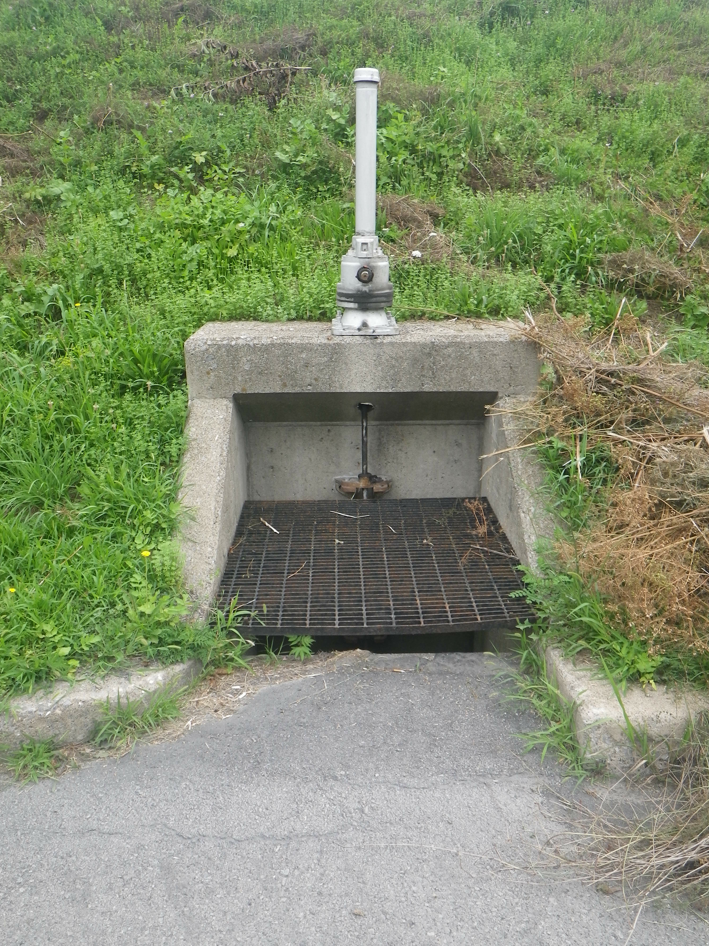
Drain and inlet
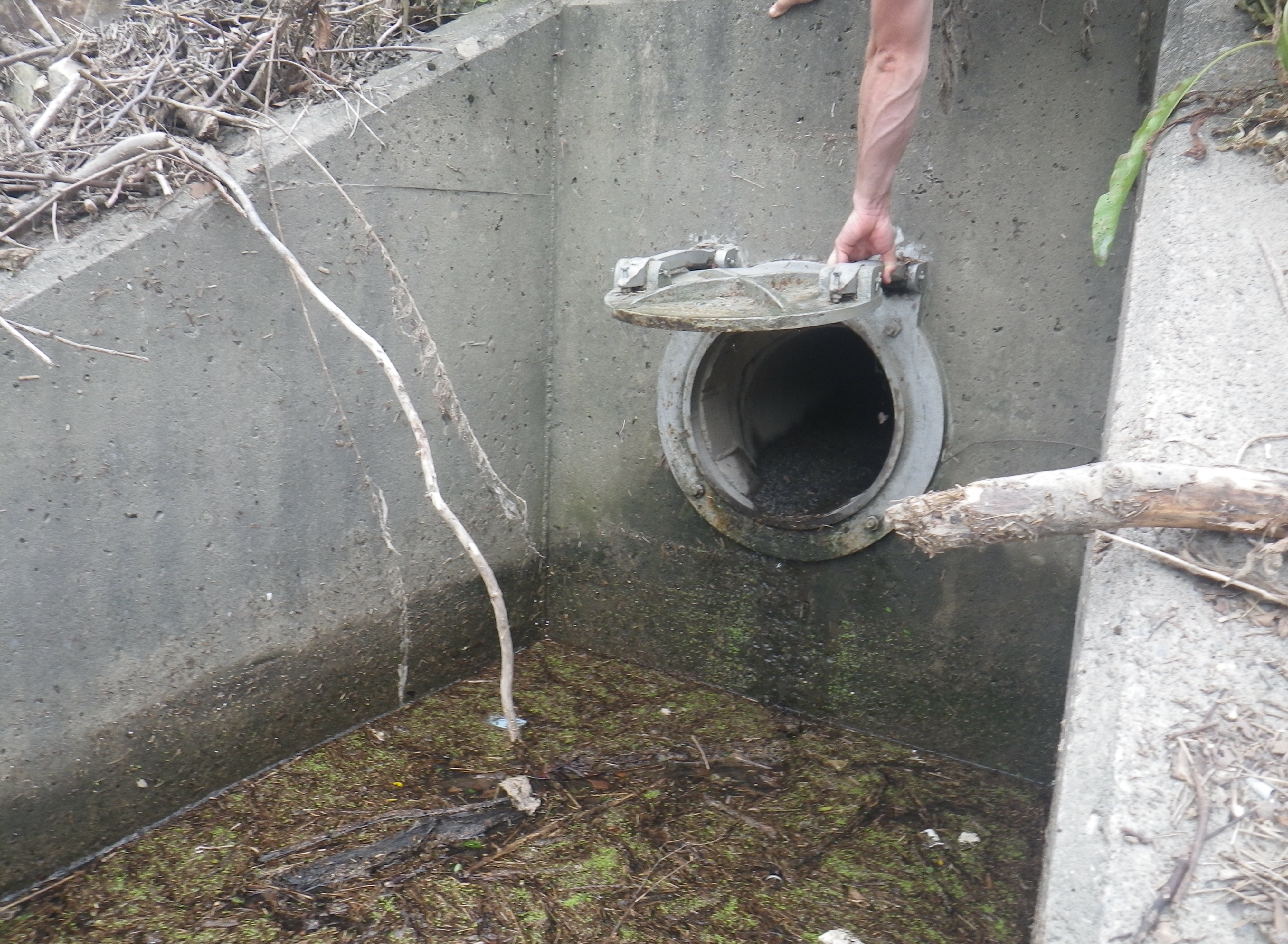
Flapgate outlet, minding out for snakes!
The systems we inspected were built from the 1940s onwards and were simple and robust in their design using, as one would hope, gravity where possible. There were a couple of pump stations with standby generators where gravity had to be overcome. As the drawing shows below a lot of effort is taken to remove the debris and sediment from the flood water to protect the pump and prevent it clogging the pipe work (or pressure conduit to use the vernacular).

Pump station
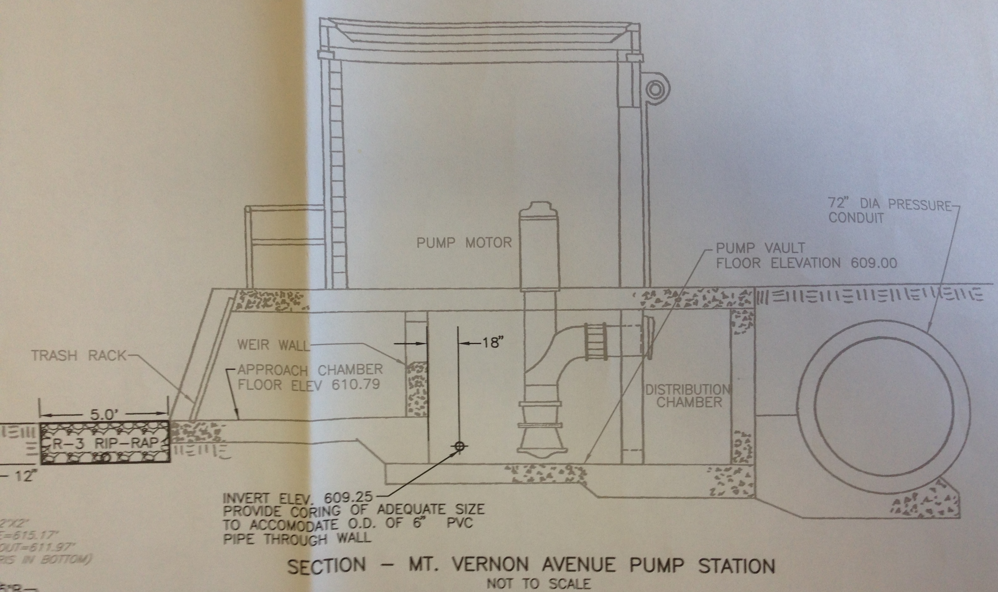
Section through pump station. Water flows L – R
Rip-rap is 6” diameter rough stone.
As far as analysis goes the question in my head this week has been how does it all integrate? My conclusion is that it doesn’t. Responsibility for each levee has been pushed down to the lowest level of government, the Township, and so there doesn’t appear to be an appetite for integration from one to the next. That said, as the map below shows, there is quite a lot of space between townships out here and so maybe that doesn’t matter.
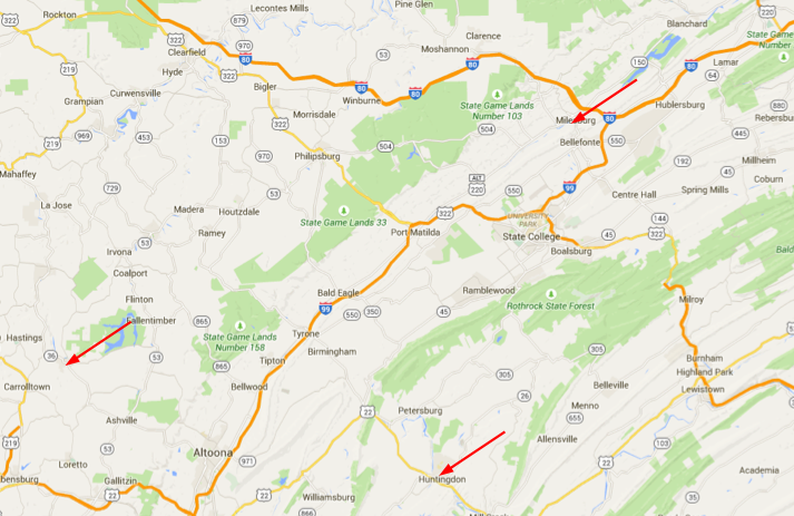
Upstate in Pennsylvania. Huntingdon is 2 hours NW of Harrisburg
I imagine further down stream towards the coast where the population density is higher and all the water converges this would be more of a problem. For now I am going to shelve these thoughts and pick them up again when I get to phase 3, where I can speak to the hydro engineers in their natural environment.
Finally, for the civils who were whinging about making a cofferdam, this is how you do it ‘redneck style!’

Simples!
And apparently this is a salad…

You can just see a piece of salad poking out under the chips and cheese

Once upon a time America was home to beavers and the rain fell gently on the prairie, meandered its way down stream through natural lakes and ponds created by beaver dams until it eventually reached the sea. Then the Mayflower arrived… The source didn’t change but the beavers did provide meat and fur and once their dams were removed there was good fertile land next to the rivers. building leves meant water didn’t flood the useful land. Increased conveyance, however, meant reduced time of concentration and so greater peak flow. This meant the next point downstream flooded unles their engineers also built a leve to improve the conveyance downstream and so on unitl leves carried the increased peak flows past the settlements to the sea.
This was OK as long as heavy rain didn’t occur at the same time as spring high tides and onshore winds which would lead to water not being disposed of at the end of the leve. This had the potential to cause the overtpping of the leve adjacent to the coastal settlement (naturally in the river basin). The sort of event that might cause problems would be the rain you get with low pressure huricanes that give higher than normal high tides.
It might be suggested that failure to be aware of the implications of their actions had lead the engineers of the leve sytem to put furtre residnets of coastal towns at risk. Huricane Catrina and New Orleans would imply that it did. But before we laugh at the foolishness and fallibility of these engineers we should perhaps pause to reflect that the engineers at that time were the King’s engineers… Now about the legacy responsibility for hollistic consideration of integrated drainage systems… I look forward to your phase 3!
Henry,
Nice salad. If the responsibility of each levee is pushed down to local level who picks up the bill for any remedial work that your inspections pick up and who carries the risk if that advice isn’t acted upon?
Good memories. I remember scratching my head many-a-time regarding the management and engineering surrounding the flood protection system across the Chesapeake watershed and trying to make some sense of what was going on – in short everything boiled down to money (and the lack of it) Very few people I have found have a really deep understanding of the PL84-99 programme that governs all emergency works and flood protection management. Rather than steal your sandwiches, I’ll let you answer Rich and unravel the typical US bureaucracy surrouding the programme!!
Of note however, have you discovered yet that a large majority of US levees are 2 foot too short for the design flood (1 in 200)??
Richard. I don’t know how old the oldest levee in PA is but according to the locals the second oldest was built in 1940, at Smithfield the subject of the first photo. To that end I don’t think we have any liability to assume there, but I have no idea about the South…
Rich. Reference responsibility, from what I understand the township are responsible but if they meet our inspection standards then they are able to apply to the Federal Government for repair funding if the levee fails. For example the levee repair Howard conducted was funded 80% by USACE and 20% by the township; in addition the township got helped out by the state with their 20%
As for understanding the PL 84-99, I am not in the right place to do that here so I may look into that in Phase 3. I’d not heard that it was specifically 2ft that most levees were short but I’m pretty glad that we live on a hill.